Washington D.C., a city visited by people from all around the world, offers a plethora of attractions. However, for first-time visitors, it might be overwhelming to decide where to go first. In this article, one of the helpful tips to efficiently reach your desired destinations is to understand the addressing system in Washington D.C.
The Four Districts of the District of Columbia
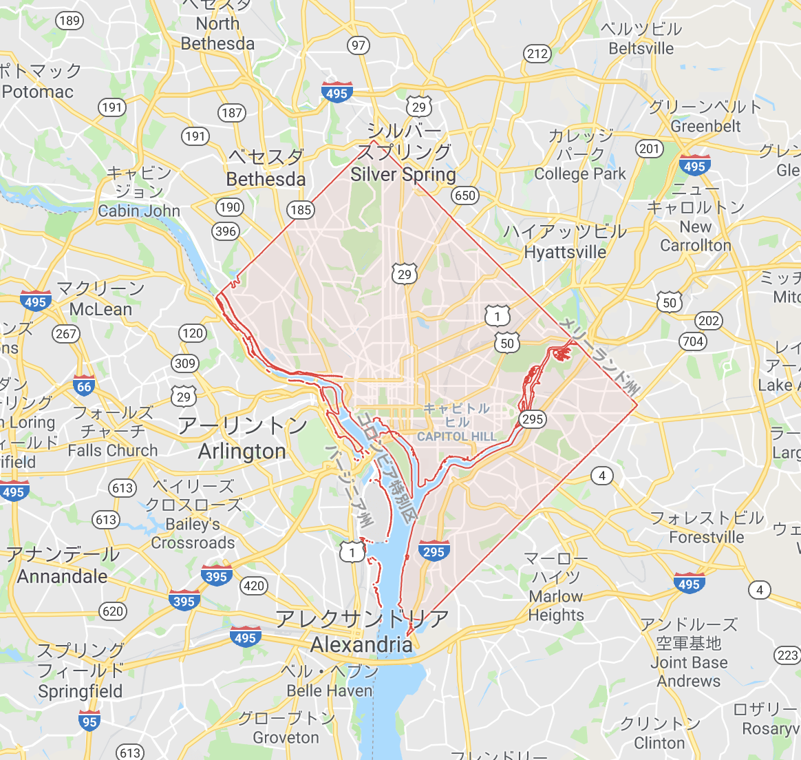
Washington D.C. is divided into four districts, with the most visited areas by tourists being the Northwest and Southwest quadrants, as well as Arlington, Virginia, located across the Potomac River.
This article will focus on the information related to Washington D.C.
The Layout of Washington D.C. resembles a Diamond Shape, with the Capitol Building slightly to the East of the center. Therefore, the Western district is more extensive than the Eastern district.
The Eastern District is mainly a Residential Area
Heading east from the Capitol Building leads to residential areas with few tourist spots.
In the vicinity of the Southeast quadrant’s Anacostia neighborhood, you can find Nationals Park, the home stadium of the Washington Nationals baseball team. However, this area is known for its high crime rate, so it’s advisable for tourists to avoid visiting.
Union Station area is also worth mentioning, as it becomes a gathering place for panhandlers at night. Although the station itself offers many shops and serves as a tourist spot, it is essential to maintain a high level of caution due to both positive and negative aspects of the location.
Spots for Sightseeing are Concentrated in the Western District

Many governmental institutions like the White House, as well as memorials such as the Lincoln Memorial, are concentrated in the Western district. The Northwest quadrant, in particular, is the heart of D.C. tourism, and getting familiar with this area will help you grasp the geography of Washington D.C.
Washington D.C. Streets: Matching Coordinates with Functions
The streets in Washington D.C. can be classified into two types: north-south roads and diagonal roads. Among the north-south roads, numbers are assigned, with 1st Street running east to west from the Capitol Building. Along this road, you can find significant landmarks such as the Library of Congress, the Supreme Court, and Congressional offices, making it a good reference point.
Additionally, there is another road running south to north called Capitol Street. As you move one block to the east or west from this road along the Y-axis, the numbers increase by one.
As for the X-axis roads, East Capitol Street runs only in the Eastern district and is not commonly used by tourists. Instead, the X-axis in the Western district is occupied by the vast National Mall. The roads running east to west on the northern side of the National Mall are Constitution Avenue, while on the southern side, it is Independence Avenue.
If X-axis has numbers, what about the Y-axis? East-west roads are named using the alphabet.
Efficiently Navigating with Street Coordinates
East-west roads in Washington D.C. are named using the alphabet. Therefore, the intersection of north-south roads with east-west roads is expressed as a combination of a number and a letter, such as 14th Street and K Street (14K).
These coordinates indicate the intersection of 14th Street and K Street. You can use this notation as a landmark to find your way to your destination without getting lost.
Furthermore, the road signs you frequently encounter at intersections have two-letter abbreviations, such as NW, which denotes the name of the district. For instance, NW indicates the Northwest quadrant.
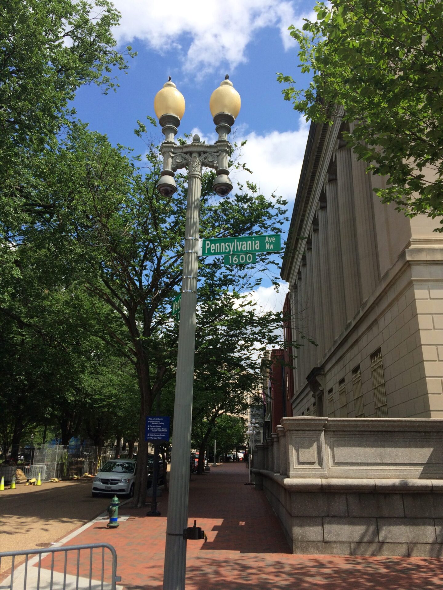
The Address of the White House: 1600 Pennsylvania Avenue
The city’s layout includes broad diagonal roads that intersect the north-south and east-west roads. These diagonal roads are named after U.S. states, and one of them is Pennsylvania Avenue, which runs diagonally from the west of the Capitol Building to the Foggy Bottom Historic District in the northwest.
In the Northwest quadrant of Washington D.C., addresses on streets running north to south increase in number as you move west from Capitol Street. The location of the White House is between 15th Street to the east and 17th Street to the west, both running north to south.
The 16th Street runs north to south from Lafayette Square, located just north of the White House. As a result, the White House’s location lies on the extension of 16th Street.
Regarding the last two digits of the address, “00” refers to the building number within the same block. The White House and Lafayette Square are both located in the same block, but Lafayette Square faces H Street. Thus, the White House’s address is expressed as 1600 Pennsylvania Avenue NW.
Enjoy Strolling Around Washington D.C. like a Local Resident
So, how was it? Washington D.C. is a carefully planned city, with a logical design of streets and addressing systems.
The north-south roads have sequential numbers and alphabets, while the diagonal roads are named after U.S. states. By using these systems as landmarks, you can quickly reach your desired destinations in Washington D.C. When you visit the city, be sure to keep these tips in mind to explore like a local resident!
